
Online point cloud viewer.Open your scan. Look closer.
Explore your point cloud in the browser. Orbit the site, walk through the space, and inspect individual points. When you find the area that matters, ask your AI agent to help you measure, compare or reconstruct it.
Start free · Already have an account? Sign in
“Show me the antenna panels and mounts. Which parts need a closer view?”
Example request to your agent
- Browser
- Orbit, walk and inspect points
- Free inputs
- PLY, PCD, E57 and GLB
- Next step
- Ask, measure or reconstruct
A scan you can explore, with an agent that can work in it.
Received a scan from a surveyor or captured one yourself? Open the scene, find the area you care about and inspect what is visible before deciding what needs to be measured or modelled.
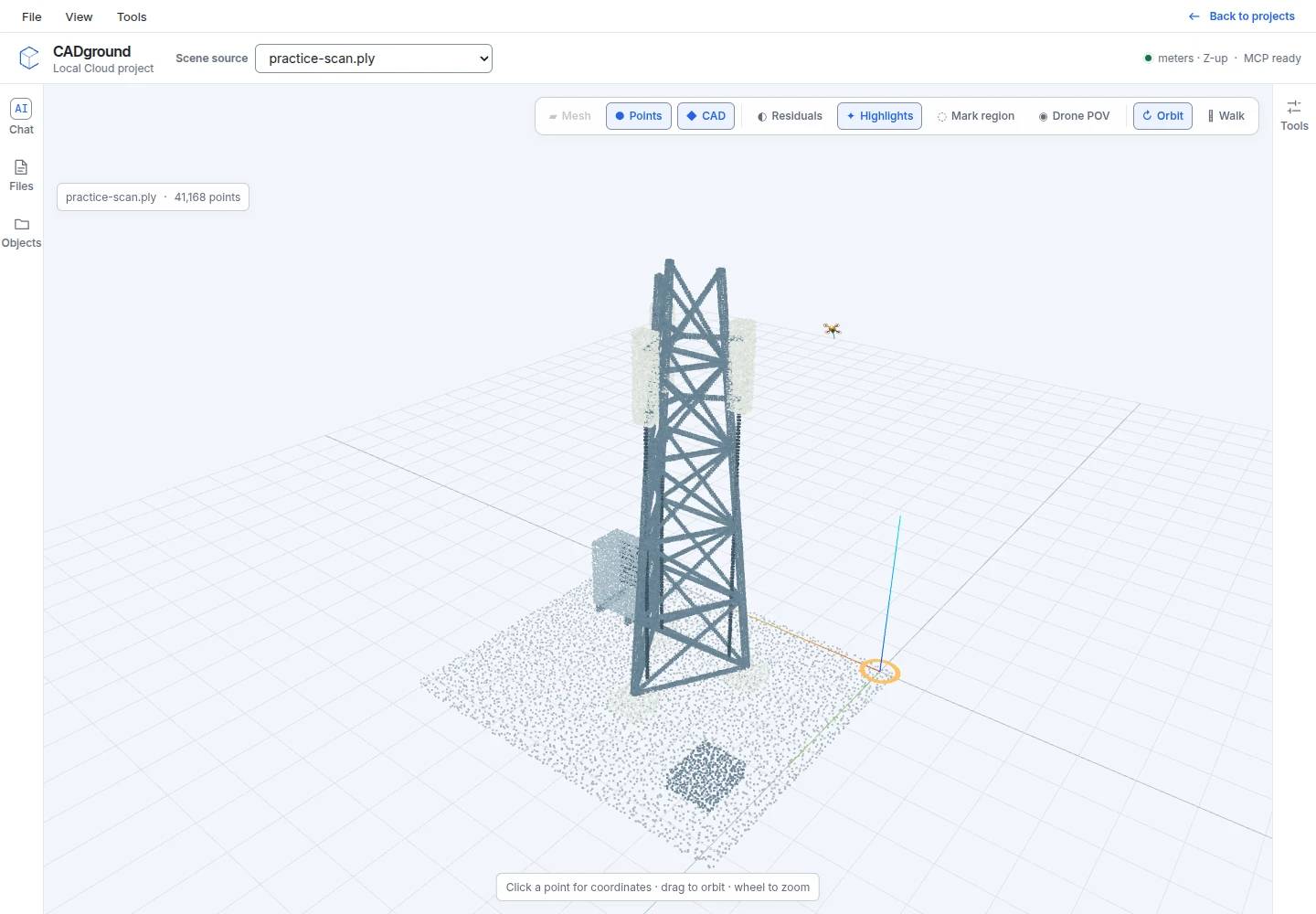
Explore a telecom installation
The practice scene includes a mast, three panel bodies, mounts, cabling and a ground cabinet. Use different viewpoints to separate overlapping objects and avoid counting the same panel twice.
- Orbit the mast to inspect panels and mounts from multiple sides.
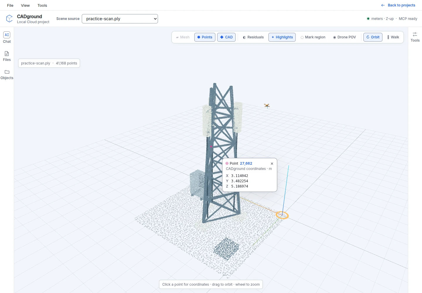
- Select a source point to read its coordinates.
- Ask for a closer view or a specific equipment dimension.
Original synthetic practice data, not a customer survey. Reference dimensions describe the constructed scene. Download the PLY, create an account, and choose it when creating a project. Upload instructions.
From your scan to a reviewed result
-
Choose a file
Create an account and a project, then select a supported point cloud or model. PLY, PCD, E57 and GLB are supported scene inputs on Free; LAS and LAZ require Pro.
-
Find your viewpoint
Use Orbit to look around an object or Walk to explore the space. Move closer to an opening, connection or equipment area. Keep the source layer visible while inspecting it.
-
Inspect and ask
Select points for coordinates, or describe the object in Chat. Ask the agent to locate it, take another view, measure a gap or explain which part of the source is unclear.
-
Continue with a task
Turn the inspection into a measurement, comparison or CAD reconstruction. Review the work in the same scene and download the generated files from your project.
Try this request in Chat
Inspect this telecom point cloud. Find the visible panel antennas and show them from different sides so the same panel is not counted twice. Identify mounts or cabling that need a closer view. Keep uncertain items in a separate list.
Adapt the objects, dimensions and output to your project. See the workspace controls →
Once you can see the scene, ask for the work you need.
The viewer gives you a shared spatial reference with your agent. Use that context to move from looking at the scan to answering a concrete project question.
- Inspect existing conditions
- Locate visible objects, check the available coverage and pick points for coordinates. Keep unclear or hidden areas explicit.
- Measure and compare
- Check dimensions or compare supported model geometry with the scan. Confirm alignment and units before using a difference in a report.
- Reconstruct and document
- Ask for selected CAD geometry, annotated views or a report. Review the result before exporting or sharing the downloaded files.
Before you start
Do I need to install a desktop point-cloud viewer?
No desktop viewer is required to use the hosted CADground editor. Create an account, open a project and work in the browser. Your scan is uploaded to the project; this is not an anonymous, local-file-only viewer.
Which point-cloud formats can I open?
Free supports PLY, PCD and E57 scene inputs, plus GLB models. LAS and LAZ scene inputs require Pro. A PLY can contain different kinds of data, so confirm that your export is a supported point cloud or mesh. See formats and preparation.
Can I open a phone or drone scan?
Yes, when the capture tool exports a supported point cloud or model. Export the actual geometry, not only a screenshot or a Gaussian-splat file. The capture guide explains the options.
Can I open a large scan?
File size, point count, device memory and project capabilities affect the workflow. Start with the area you need to inspect. Follow the preparation guide to split or prepare a large source without losing its coordinate reference.
Can my own AI agent use the workspace?
Yes. CADground provides an MCP connection for compatible AI clients. Use the project’s connection instructions so the agent works in the intended workspace. See the MCP setup guide for the supported clients and steps.
Open the scan you need to understand.
Use your own data, or begin with the telecom practice file.